Reflecting on the relative size of things can make one feel very small. The measurements of a favorite trail, say, projected on the Cascades, extended to the western US, zoomed out to the entire North American continent, earth, planets, galaxy, and on and on…
Considering the eons of time can likewise make one feel insignificant. Relative to the expanse of space and time our existence seems to be a mere dot on a dot, on a dot, on a speck, for a brief wisp of time.
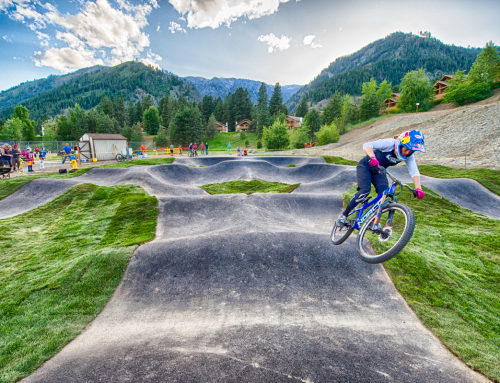
In defiance of this perspective the mountain rider attempts to add a measure of significance with an infusion of soul, dirt and understanding through the experience of the ride. Pushing to new limits of both climbing and descending, on technical trail while riding with style. A measure of riding progression; not just a bland clipped-in, vertical-smashing, thunder-thigh endeavor. But a natural flow infused with adrenaline and endorphins alike. The true ride is a rugged turbulent experience in the most remote mountainous regions not simply a smooth timed race. In the Pacific Northwest there are many trails with features that provide countless opportunities to express creativity through riding. But to stretch the scale of possibility, the rider must continually pedal quicker, turn sharper, climb higher, descend faster and of course, go bigger. So where does one pursue a personal journey of heightened riding discovery to raise the bar of measurement? Is style relevant if nobody is there to see it? Can one find significance in this world through nothing but personal achievement, and if so, do these conquests really matter relative to others? To find answers down this trail of thought will require riding a very large mountain…

In the Pacific Northwest the highest mountain is of course, Mt. Rainier. Not really a feasible option for biking though given all the snow, glaciers with crevasses and such. So how about Colorado with all those 14-ers so often mentioned? Well, the problem with the Rockies is that although the heights may in fact touch 14,000 feet, the overall elevation drop of any given peak is never more than around 5,000 vertical to the valley floor with remaining elevation wasted on a near-zero gradient all the way to Kansas (and riding with red slippers, well that’s just silly). Shifting focus towards the south reveals the highest peak in the lower-48. Standing at 14,497 feet, Mt Whitney belittles our own little volcano by a whopping 86 feet! And that’s giving Rainier benefit of the doubt with the 14,411 designation rather than the older accepted historical value of 14,410. Why the discrepancy? Did Rainier grow a foot in recent decades? Plate tectonics maybe? Not really, the new value for Rainier comes from new techniques in measuring elevation. Let’s take a tangent ride…
There are plenty of different ways to measure various physical phenomenon and if you think about it: what is height anyway without something to measure it against? The only reason elevation has any meaning in the first place is the fact it denotes being higher than some other point. Measurements are inherently relative. Custom convention records vertical height as relative to a calculated geoid that closely represents mean sea-level elevation. But it could just as easily be measured relative to the earth center or even the ellipsoid of revolution like that measured by GPS. Fork in trail, take a left…

It’s a well-established fact that the earth spins on tilted axis; and this geometry, given location on orbital path around the sun, determines length of day and creates seasons. Another subtler and less known effect created from this spin is that the earth is not a sphere at all, but actually an oblate ellipsoid bulging over 26 miles at the equator. In Washington this idealized egg-of-an-earth surface is actually 63.1 feet above the reference geoid benchmark. Measurements relative to this ellipsoid slightly reduces Mt. Rainier elevation, while to the south Mt. Whitney loses even more. Like a young Rainier striving to measure-up by standing straight as his southern big brother slouches. This convention narrows the pencil marks to less than 40 feet on this particularly big doorjamb. Continuing to belittle more beloved peaks consider if elevation were relative to the center of earth. The tallest mountain, Mt Everest, would be unseated by Mt. Chimborazo in Ecuador as the highest spot on earth (closest to the moon, planets, sun, outer-space, etc…).

Now calm down all you mountaineering purists. Just simply clarifying that elevation is relative, and mincing tens-of-feet differences between peaks is a bit futile. In fact, to take it one step further there’s yet another way to look at this. Due east of the Sierras, a relatively younger (than Whitney but much older than Rainier) and unknown mountain range (alas the middle sibling is always overlooked) has been rising over the past 10 million years. Stretching up to a whopping 14,252 feet these hills are home to the 5th highest spot in the contiguous US, White Mountain Peak. The immediate proximity of this peak with Death Valley, which is 282 feet below sea level, is notable. So rather than calculate this mountain elevation relative to the geoid or ellipsoid, it almost seems more appropriate to measure it relative to the valley floor [14,252 – (-282) = 14,534ft] making White Mountain Peak #1 of the contiguous US! Of course we established earlier that these differences are decidedly moot. What is of concern for riding is that of our mountain family: Rainier has obvious terrain barriers unsuitable for bikes, Whitney has political hurdles, and it’s simply ridiculous to consider their parents Mt. Everest and Chimborazo. Main trail ahead…

Back on track in quest of adding measurable size to our seemingly insignificant selves there is potential in a place where mountain bikes thrive above 14,000 feet, trails are remnants of our exploring ancestors, and trees are older than the hills. And it is this place where riding pushes the envelop of vertical limitations. With over 10,000 feet of vertical relief and 12,000 cumulative from peak to valley floor, White Mountain Peak is pure gradient free riding flow.

The trail twists and turns to the summit of White Mountain Peak where 35-PSI tire pressure becomes an effective 50 and your head swims. The summit is like a wispy summer’s eve: calm, cool and quiet. The trail tread is a stark contrast to the loamy northwestern single-track. Loose rock and formidable terra firma scrapped with pioneer mining cart paths that are hundreds of years old are the challenge. It’s all about drifting turns and dodging cactus –ever bit as technical and much less fabricated than a built-for-purpose bike trail. A super fast floating ride in sunny, clear, dry, desert air. Add a dose of pioneer history and a meeting with the Tree Ents in the oldest forest on the planet and you’re headed down a path of significance.
After rushing the first raging rocky descent of a modest 6,000 feet, the trail winds down into a foregone forest where the oldest living being in existence on earth resides, the Bristle Cone Pine. Enduring fires, droughts, storms and lightning strikes, these ancients are wise beyond time. Riding into the nexus of this forest is to engage in a slow thoughtful conversation on the space-time continuum with respect to relative velocity. In this dialogue, Methuselah confirms that the discrepancies in measurements are simply perceived, so not to worry. At 4,844 years old, he speaks of times long gone when his mountain was much taller. To him, mountains rise and fall like waves in the ocean. Time is relative.

Daylight wanes leading to realization that this forest gravity has slowed the senses of normal perception –so much more to discuss but not enough time… Living too fast, understanding too slow. Dropping in, the remaining 6,000ft descent from the ancients to the valley floor through Silver Canyon is littered with metal deposits and craggy rock. The trail blurs as velocity exceeds the language of trees, rocks and even the Bighorn Sheep dotting the cliff face. Back at the valley bottom the first rills of water begin to coalesce along with fresh experiences of ancient understanding.

Knowledge engrained from climbing 12,000 vertical feet and descending the same. All in a single continuous ride. All pedal-driven. All in pure style. Just another speck of dust adding weight to personal character through achievement and expression. Did it tip the scales compared to a Pacific Northwest ride with less vertical, softer soil and denser canopy? Or more significant than a central Washington ride on Wenatchee Sandstone, Columbia River Basalt, Leavenworth granite? More hardcore than pinning berms, whipping gaps, or tricking drops? Why style when no witness can externalize? Desert southwest or forest northwest? Do decade dated trails ride better than century old mule tracks? Is it better to consider the earth as an ellipsoid or geoid? What is significant anyway? Does it matter?
Towering centenarian Cedars do speak much faster than twisted millennium Bristlecones… but by listening intently they both tell us that living the experience of The Ride is what does matter.
It’s not a measure and therefore not relative at all.